Become a member
UPDATED- Comment Period: Upper Mill Creek Canyon
03/29/2024 Update
You may remember that the Forest Service, Salt Lake County, and Federal Highways have been working on a plan to rebuild the Mill Creek Canyon road above the winter gate. There have been a few public comment periods and now the final Environmental Assessment (EA) has been released, and the public comment period closes April 5, with construction (and a two year complete upper canyon closure) starting in the summer of 2025. While these entities did not make any changes to the plan after last summer’s presentation and public comments, it’s important to share your opinion one last time.
In last summer’s public comment period over half of the commenters decried the widening and straightening of the road (SLCO denied WBA the raw comments, but we obtained them via a Freedom Of Information Act request) yet there was very little acknowledgement of this, and the design: 10-foot lane widths all the way to the top, with a 4-foot bike lane going only to Elbow Fork and abruptly ending there because “only some” cyclists ride past Elbow Fork to the top (according to Strava statistics 90% of cyclists continue) even though 9-foot lanes are a Federal Highways standard. Originally they used a strong safety argument for the wider lanes, ignoring many recent definitive studies showing that it’s vehicle speed that endangers cyclist and pedestrian safety, not lane width, and wider lanes/straighter roads (ala the lower canyon) generate higher speeds and in the final EA there was almost no mention of improved emergency vehicle access, even though that was also a big justification earlier in the process.
Additionally, although last summer’s presentation talked about accommodations in strategic parking areas for a future shuttle bus – something that again half of public comments have supported – there is no mention of “shuttle” in the EA, only vague mentions of “vehicle drop off points.” The Forest Service seems determined to avoid committing any resources towards enabling a much-needed shuttle, despite offers of financial and administrative assistance by the Central Wasatch Commission and the results of a 2012 study commissioned by SLCO that not only strongly advised a shuttle but also designed an entire program. The FS is balking at even doing an environmental analysis due to the lack of existing parking, even though the CWC has worked with Millcreek City, UDOT, and Skyline High School to identify reasonable shuttle parking options near the mouth on both sides of the freeway.
So please submit your comments! Again, the important points:
- Mill Creek Canyon is a small, intimate canyon with an aesthetic, unusual road that is used almost exclusively for recreation and lanes can and should be no more than 9 feet wide.
- Some sort of bike lane should go to the top, or at least commit to a big shoulder.
- Minimize road straightening and increased sight lines,
- Figure out a way to keep the road open to cyclists during the construction summers of 2025 and 2026.
- Demand a shuttle, and point out that there are viable parking options near the mouth that have tacit approval.
In an era where many planners are not always all about accommodating cars – particularly in recreation-only forested areas – simply enhancing vehicle access is shortsighted and will degrade the intimate upper Mill Creek Canyon experience for us and future MCC lovers forever.
“To be considered in the decision-making process, written comments on the EA’s analysis and results of the environmental impacts of implementing the proposed action must be received by April 5, 2024. Please provide any written comments to Central Federal Lands Highway Division, 12300 W. Dakota Ave Suite 380, Lakewood, Colorado 80228 or via email to millcreekcanyonroad@dot.gov
Learn more about the proposed project here. Read more from our previous blog blow…
The recording of the county council meeting of February 27 where Mayor Silvestrini, SLCO, USFS, and the consultants made a presentation to the County Council. The presentation starts at 31 minutes. At 1:10, a private citizen and member of the CWC’s Mill Creek Canyon Committee reflects some of the problems that the Mill Creek Canyon Committee saw with the process and the final product (so 50 mins total; about as long as a good podcast!). Here’s the link to the video recording.
Comment Period: Upper Mill Creek Canyon Road Improvements Project
Published July 8, 2023
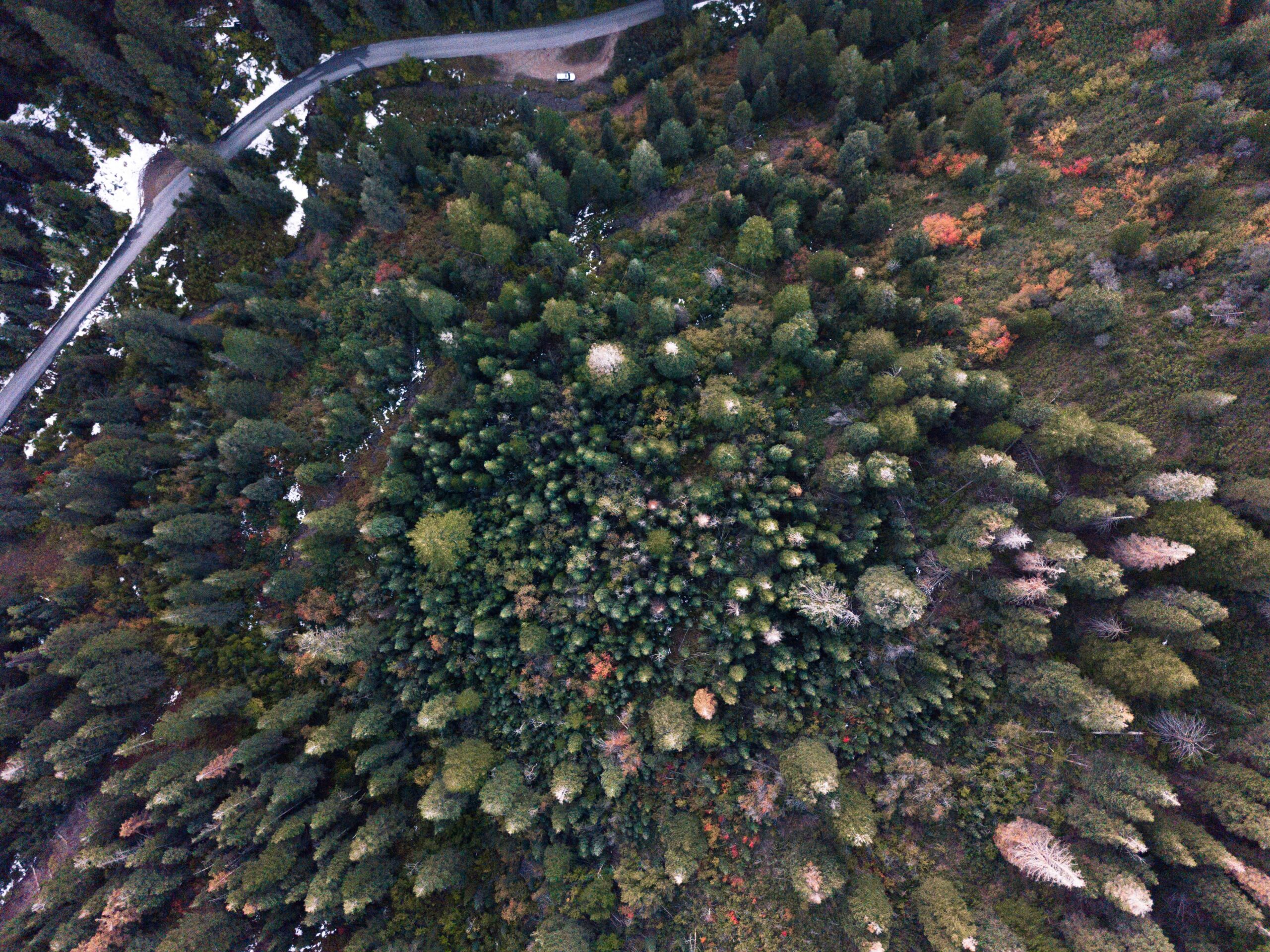
Mill Creek Canyon has long been a beloved refuge for Salt Lake City residents seeking a quick escape to great trails, cool picnicking, challenging Nordic skiing, high-quality road riding and mountain biking, and backcountry skiing. The road above the winter gate, in particular, gets slower, more intimate, and is the gateway to the vast network of trails at the top of the canyon.
It is this section that the US Forest Service (the FS, which owns the land), Salt Lake County (SLCO, which owns/maintains the road), and the Federal Highways Administration (FHA) chose to focus on for a Federal Lands Access Program (FLAP) grant from the federal government’s gas tax funds.
They were awarded $19 million, and so far, it’s been a 2.5-year process to outline the purpose and need (presented at an open house in December 2021), a first round of design concepts (May 2022) and a second round of designs (June 2023).
If you’d like to see the entire presentation from the June open house, it’s here (an hour and 20 mins; worth a listen/watch).
The Salt Lake County Office of Regional Development is accepting public comments until Monday, July 10. You can learn more and submit your comments here.
Here are the fundamentals of the latest design:
- A 24-foot roadway from the winter gate to Elbow Fork, consisting of two 10-foot lanes and a 4-foot bike lane on the uphill side of the road.
- A 20-foot roadway from Elbow Fork to Big Water, consisting of two 10-foot lanes and no bike lane.
- Straightening the road for improving driver sight lines.
- Allowance for narrowing of the roadway for sensitive/awkward places such as Thousand Springs and the very top of the canyon.
- Replacement of the White Bridge about a mile above the winter gate.
- Shoring up/replacing the road surface to avoid tarmac falling into the creek.
- In addition to riparian preservation, the overall goal is to enhance access and improve safety for canyon travelers, particularly cyclists and pedestrians, and “improve driver expectations.”
- Design opportunities for future implementation of a shuttle (stops/unloading zones, turnarounds).
- Build retaining walls to keep the road in place and from being overwhelmed by adjacent steep hillsides; the walls would blend in visually and could be up to 8-10′ tall.
- Discourage undesignated roadside parking to avoid shoulder and riparian degradation.
- Add formal parking spaces at key trailheads (Elbow Fork, Alexander Basin, and Big Water).
As always, there are good and bad things with this government project. They took the acknowledgment and mitigation of environmental impacts much more seriously this time than they have indicated in the past, and felt like they “struck a balance between the cyclists, motorists, and environmentalists.” (is there a difference?).
However, a big red flag is the termination of the bike lane with no other consideration for cyclists above Elbow Fork. The rationale provided was that “only some” cyclists ride above Elbow Fork. We are not sure how many “some” is, how they generated this vital statistic, how many “more” cyclists it would take to be more than “some,” and why — if cyclist safety is as much of a concern as they say it is — they are willing to forsake cyclist safety in the upper 3 miles of the canyon.
Ten feet is a general national standard for lane width — and in this project, it has shrunk from the originally-discussed 11-foot lanes — but it is not a mandate, and 9 feet is an acceptable width according to the FHA. Most cars are about 6 feet wide, pickups and vans are 6.5-7 feet, and even big trucks are 8 feet wide.
To be considered and designated a formal “bike lane,” a lane needs to be 4 feet wide, but in the lower canyon — and in Big Cottonwood Canyon, which has seen a lot of work lately — there are “wide shoulders” that are effective bike lanes.
If it’s important to you, suggest narrower auto lanes and wider shoulders that will indeed accomplish their oft-stated goal of increased cyclist safety.
In the earlier designs, they had introduced some more modern cycling-oriented road designs (no striping at all, which inherently lowers auto speeds, variable-width lanes), but seemed to default to only accommodating cars when presented with the challenge of a narrower roadbed, despite the popularity of cycling up the canyon and cyclist safety being far and away the most common comment from last year’s open house comment period.
WBA plans to work with the FS to get counts of cyclists over the rest of the summer entering the canyon, at Elbow Fork, and at/near the top of the canyon.
The road builders are determined to increase safety by widening the lanes and straightening the road, thereby increasing sight lines. But, statistically, there have been virtually no accidents in the upper canyon over the last 30 years. WBA has gotten confirmation from the local Fire Authority that they have no problem with their vehicles going up the canyon as it is.
Initiating a shuttle bus pilot program was the major recommendation of a 2012 study by some consultants hired by SLCO, but was originally excluded in the context of this project. The fact that not only are aspects and accommodations for the shuttle being included in the latest design but also the FS, in particular, appears to be interested in initiating the lengthy NEPA process associated with adding a shuttle prior to finishing the road project is welcome, and they deserve kudos for this vision. The same goes for adding some much-needed restrooms.
Construction will be a big deal, and there is talk about closing the entire upper canyon for two summer seasons. It is worth reminding them that there are ways to do partial closures to allow access during construction with thoughtful management.
The project has moved from being an alarmingly large change to the intimate nature of the canyon to slightly more subdued, but this will be a once-in-a-generation change to the upper canyon. Your comments are critical to reminding the agencies, and consultants who they work for, what the experiences are for people who actually use the canyon.
So please take the time to submit your comments by the end of the day on Monday, July 10 either via the website’s comment form (it has limited space) or simply send them to millcreekroad@slco.org.
Thanks for your activism!
Join the WBA newsletter for Central Wasatch backcountry events and news.
More articles
-
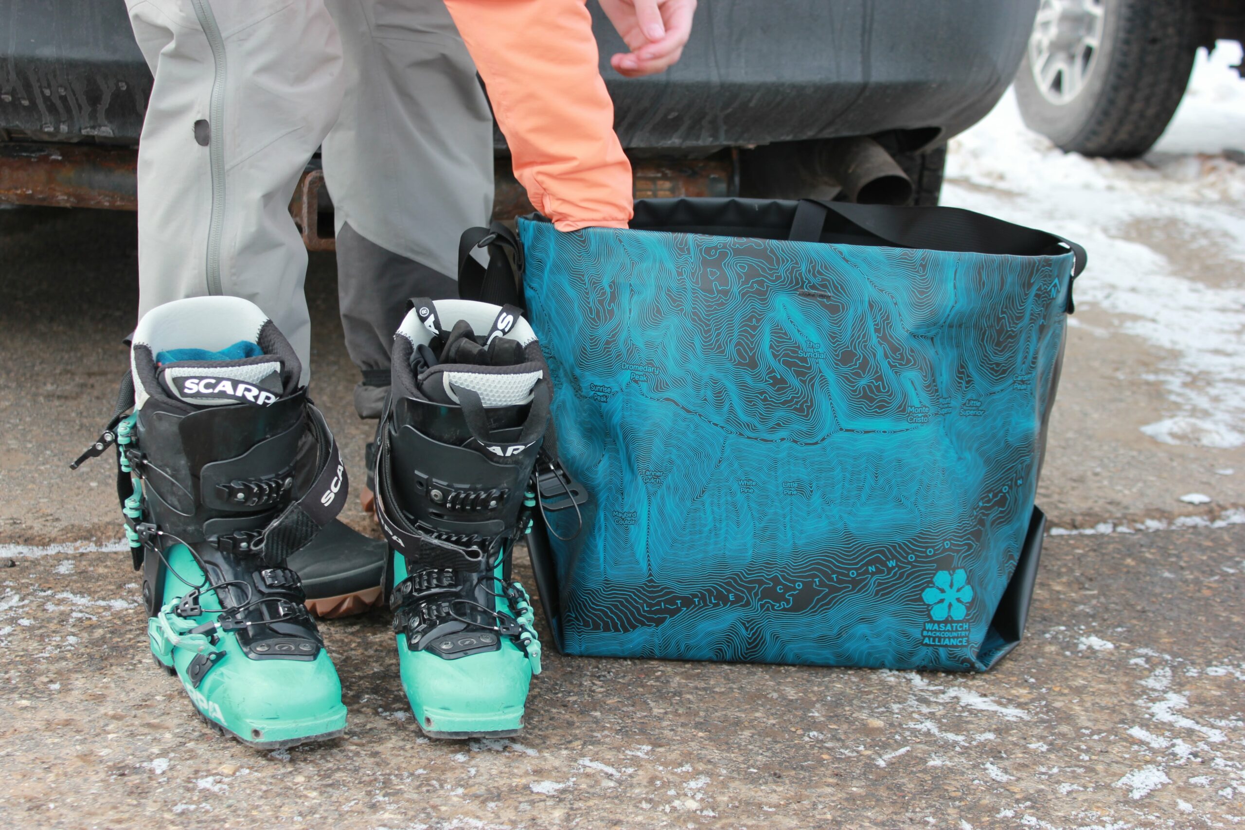
WBA x eqpd GearBuckets
We are stoked to introduce the eqpd gear Wasatch Backcountry Alliance GearBucket! Stamped with the Little Cottonwood Canyon topo map, the GearBucket combines the usefulness…
-
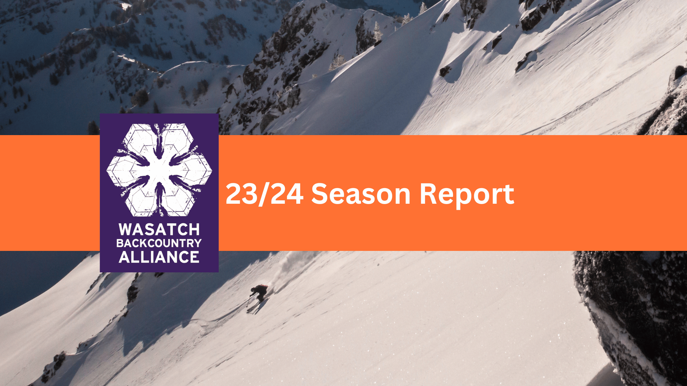
23/24 Season Report
Wasatch Backcountry Alliance published our first-ever season report from the 23/24 winter! For the past 10 years, WBA has been run by a volunteer board…
-
Cheers to the Wasatch!
Let’s make a lasting impact together! A note from our Director, Dani Poirier Like many of you, the Wasatch is where I learned to backcountry…
-
UPDATED- Comment Period: Upper Mill Creek Canyon
03/29/2024 Update You may remember that the Forest Service, Salt Lake County, and Federal Highways have been working on a plan to rebuild the Mill…