Become a member
Mountain Accord & the CWNCRA legislation
September 13, 2016 – It’s been some time since we provided a member update and we want to let you know what our view is of the future of the Wasatch as it pertains to the Central Wasatch Conservation and Recreation Act legislation that was introduced by Congressman Chaffetz in July. We – and everyone else involved in the process – have had to learn as we go. It seems that even when things are solid, they really aren’t, so we’ve waited to provide info that we think is accurate and concrete. But we know that as the temps cool, people’s minds start drifting towards winter like the snow that we hope will fly soon, and thought it was time to provide you with a status report.
The long-held goal of the Mountain Accord process has been a bill being introduced in Congress. Mountain Accord was formed with all the stakeholders knowing a few fundamental things:
• Because of the number of stakeholders and the huge range of interests and goals, it was going to be a difficult, messy process.
• Because of the many competing interests and goals, compromises – by everyone – were going to be mandatory.
• Mountain Accord by itself had no “teeth”; that is, there would be no state or federal mandate by simply agreeing to an “accord”. Therefore, an act of Congress would be needed to establish concreteness and longevity.
It’s not news to anyone that Utah’s congressional delegation is no friend to open, undeveloped public lands. That being the case, the goal was to give one of our four representatives an opportunity to introduce legislation that “everyone” – including the dominant financial and political interests – agreed upon, even grudgingly, even if it meant that it would “lock up” some land with no potential for future development. Chaffetz emerged as The Guy to do that. So in essence, the Accord that was signed a year ago needed to be distilled into an introduce-able bill.
From within Mountain Accord a committee was created to craft the language for the bill, try to figure out the particulars, and hire a DC lobbyist (paid for by Sandy City) to help shepherd the bill along the halls of Congress. To maintain influence, a few organizations/people created an “environmental caucus” to represent our perspective. The caucus consisted of Wasatch Backcountry Alliance, Save Our Canyons, Salt Lake Climbers Alliance, Trails Utah, the Sierra Club, the Wasatch Mountain Club, Park City councilman Andy Beerman, former Black Diamond CEO Peter Metcalf, and The Nature Conservancy’s Joan DeGeorgio (all three of whom were on the Mountain Accord Executive Committee, which has since been disbanded, since it was too big, unwieldy, and less effective/important in this phase). This year is an unusual one for Congress because the timing of the two parties’ national conventions and the runup to the election has shortened the 2016 session, so there was a lot of “hurry up” and then wait as negotiations and final touches were made. Ultimately, the bill was submitted by Chaffetz on July 11. Here is the actual bill if you’d like some light reading.
Fundamentally, here are the primary aspects (from the Mountain Accord website, with our comments):
• All existing recreational uses and permits will continue (including Wasatch Powderbirds).
• Existing Wilderness Area boundaries will be adjusted for the Bonneville Shoreline Trail alignment and for transportation improvements (in the Olympus Cove area).
• Approximately 8,000 acres of wilderness will be added (in the Mt Aire/Grandeur Peak area; both sides of the ridge).
• The U.S. Forest Service will maintain ownership and management of the lands that they already control (private lands and inholdings are maintained).
• Land exchanges between the U.S. Forest Service and the four Cottonwood Canyons ski resorts are authorized (this is big; more on this below).
• Ski resort permit boundaries on U.S. Forest Service land will be fixed permanently after some adjustments through the existing permitting process (again, big; see below).
• New roads for automobiles will be prohibited on U.S. Forest Service land.
• No restrictions will be placed on U.S. Forest Service management for fire suppression, vegetation maintenance, avalanche control or other emergency measures.
• Private land within the area or adjacent to the area being designated will not be affected.
• Future transportation improvements are not precluded and can be made on an as needed basis (yes, this means that trains and tunnels are still possible, but this is unchanged from pre-legislation and will still be subject to intense scrutiny; importantly, however, nothing is mandated).
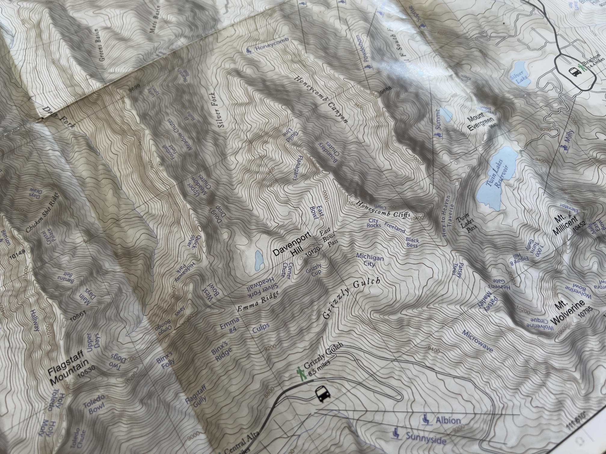
Of acute interest to the backcountry riding community are the land exchanges and ski resort boundaries. Here are the fundamentals of the various land exchange proposals:
• The LCC/BCC ridgeline and its south-facing slopes (ie Emmas, Flagstaff, Cardiff Bowl, Superior) will be permanently closed to any development potential from the Emmas west to the Twin Peaks Wilderness boundary.
• 400+ acres of land near Guardsman Pass currently owned by Deer Valley will be permanently off-limits to development (thus creating another challenge to Ski Utah’s One Wasatch proposal).
• Brighton will lock down its current boundary with the exception of being able to formally extend into the adjacent Hidden Canyon (to the north/west of the Great Western ridge).
• Solitude will be able to apply for a permit boundary adjustment to realign their Honeycomb Return chairlift.
• Solitude and Brighton will create a “SolBright” connecting chair between the resorts.
• Snowbird is locking down their LCC boundaries, but as many may know, American Fork was not included in the Mountain Accord and Snowbird has ambitious plans to expand into Mary Ellen Gulch.
• Snowbird will permanently let go of any ambitions of expansion into White Pine (which will be made into a “Special Management Area” which essentially means it’s a de facto “wilderness” but with the slight addition of helicopters – for an obvious reason – which is an odd and dangerous precedent, particularly for the mountain bike access community).
• Subject to land exchanges that include Grizzly Gulch and a transportation solution, Alta Ski Lifts (ASL) would receive more developable land at their base, and more snowmaking water.
A huge issue that has caused a lot of angst is Grizzly Gulch. In the late 90’s, ASL purchased most of the land in GG, and as you know has developed a cat-skiing operation there. ASL has been talking about putting a chairlift from ASL’s base up to the top of Michigan City/Grizzly Gulch for years. Because they own this land and it’s NOT a Forest Service Lease, they have the ability to do that, though they would likely need to go through an approval process through the town of Alta in order to do so. Wasatch Backcountry Alliance has – with your help – established that the GG trailhead is the single most popular backcountry ski trailhead in the Wasatch due to its quality and variety of skiing, relatively safe avalanche terrain, and access to adjacent areas. There is a small swath of Forest Service land near the trailhead that ASL likely needs in order to put up a viable chairlift there and that they clearly would love to own. At this point, the GG issue is still unresolved. We are in continued discussions with ASL to find a solution.
Solitude’s expansion into the bottom of Honeycomb has us worried, and we’ve been talking to Solitude’s owner/manager Deer Valley about this. The current bottom of the Honeycomb Return chairlift is very awkward and they would like to make it better by taking it down into the bottom of the confluence of Honeycomb and near Silver Fork. This creates a lot of concern for us about the possibility of creating even more sidecountry access/incentive into upper Silver Fork (ie – if resort skiers can boot the Highway to Heaven to the top of Silver Fork and then have “glide-to access” to a chairlift at the bottom of Silver Fork, it makes upper Silver Fork much more appealing and efficient for Solitude skiers). Through negotiations with DV/Solitude, they have come to understand the concerns associated with Silver Fork and agreed to limit the number of acres that they will use and take steps to avoid glide-to access from Silver Fork. We are still in discussions to identify a win-win solution.
The maps that have been included with the legislation have proven to be challenging. The difference of even feet or yards in a resort boundary placement can have a huge effect on adjacent backcountry terrain; from what we have seen, the maps that have been included with the bill are incorrect, sloppy, and do not reflect the spirit of the Mountain Accord. Specifically, at the Grizzly Gulch trailhead, there’s a small parcel that is above the Albion road near the bottom that potentially provides a bypass of FS land to access to Alta’s desired Grizzly Gulch lift alignment. WBA has been assured by the Forest Service, which will bear responsibility for execution of these exchanges and boundaries, that the maps are only “proposed” and “preliminary” at this stage and that they can be dramatically “marked up” even after the bill’s passage. However, we remain concerned, and are doing everything we can to clarify what the maps represent, and ensure all materials are accurate, and aligned with the signed Accord. While our efforts have shown significant progress, we remain concerned.
The next step in the legislative process is that there is a hearing tentatively scheduled for September 27th, but then there’s a recess from September 30th until after the election. We have been informed that the bill will not pass until a new Congress convenes in 2017, but that getting the hearing done during this Congress is a big step and accomplishment. We will try to keep you abreast of the developments and if/when there will be a need for action.
In the meantime, think snow! As you are purchasing new gear this fall, try to patronize our local ski companies Voile and Black Diamond, who have been great supporters of Wasatch Backcountry Alliance. We hope to see you at the Utah Avalanche Center’s party at Black Diamond on September 15th!
Join the WBA newsletter for Central Wasatch backcountry events and news.
More articles
-
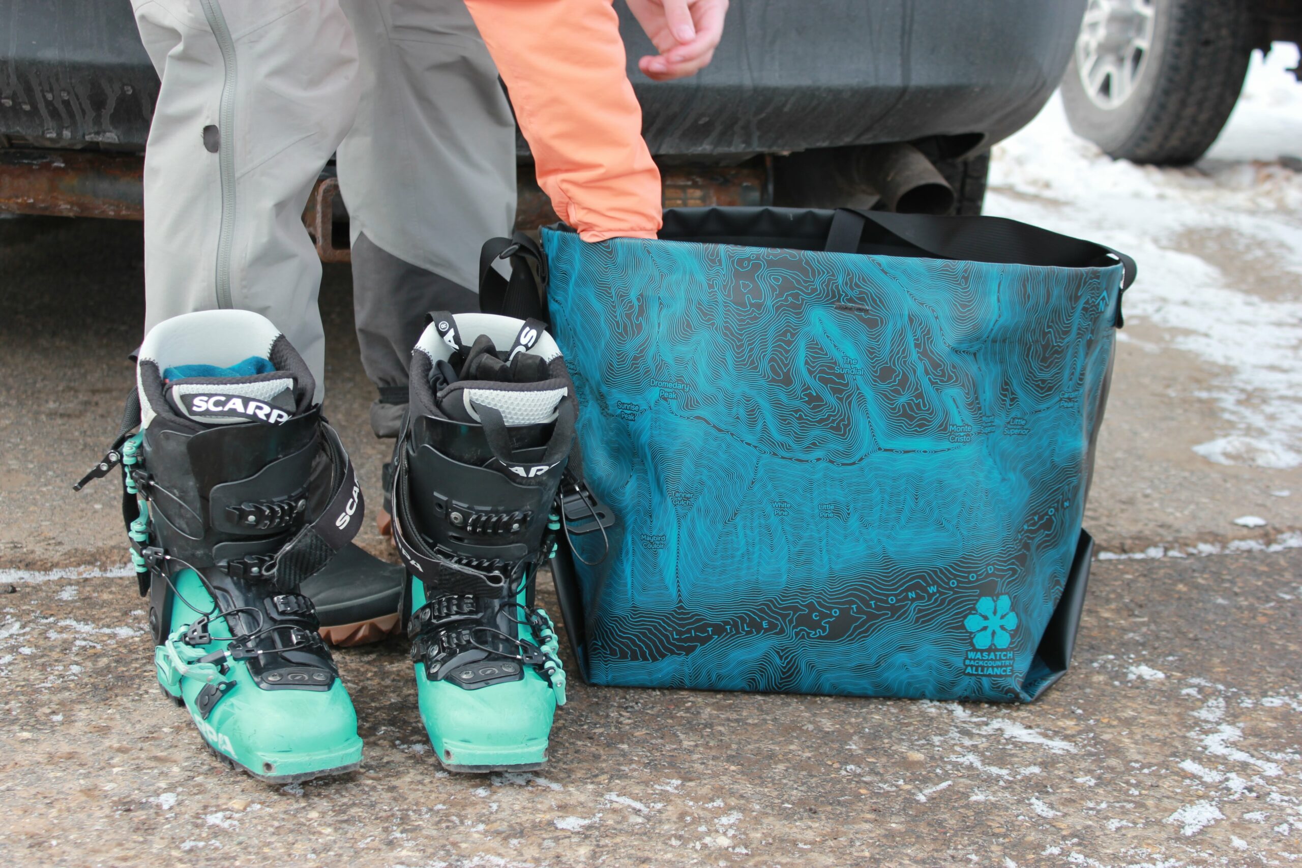
WBA x eqpd GearBuckets
We are stoked to introduce the eqpd gear Wasatch Backcountry Alliance GearBucket! Stamped with the Little Cottonwood Canyon topo map, the GearBucket combines the usefulness…
-
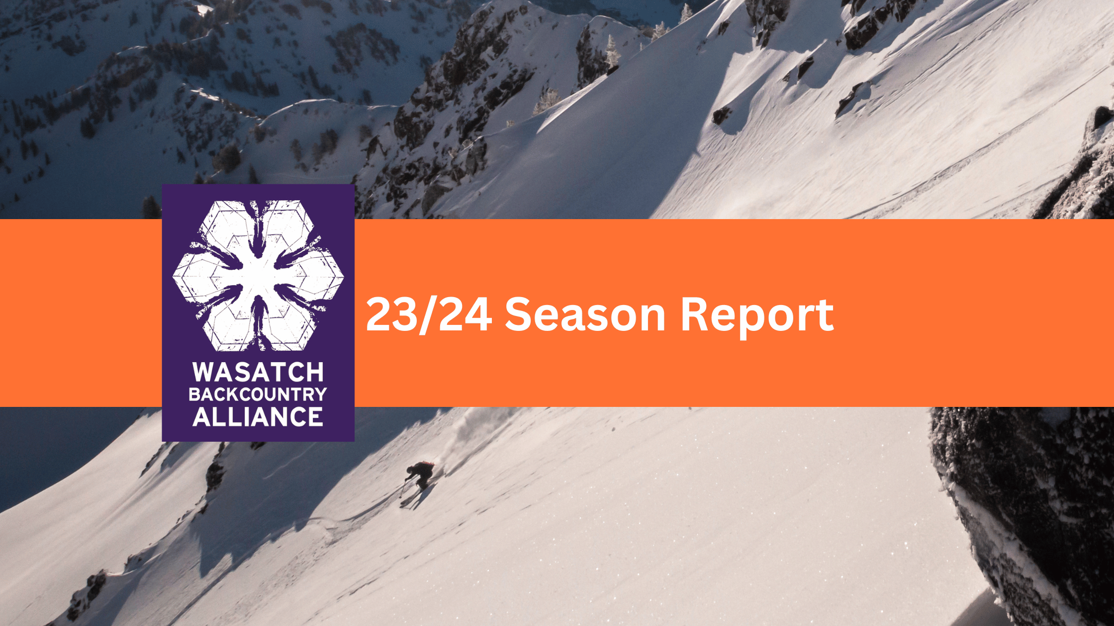
23/24 Season Report
Wasatch Backcountry Alliance published our first-ever season report from the 23/24 winter! For the past 10 years, WBA has been run by a volunteer board…
-
Cheers to the Wasatch!
Let’s make a lasting impact together! A note from our Director, Dani Poirier Like many of you, the Wasatch is where I learned to backcountry…
-
UPDATED- Comment Period: Upper Mill Creek Canyon
03/29/2024 Update You may remember that the Forest Service, Salt Lake County, and Federal Highways have been working on a plan to rebuild the Mill…